Stirling Ranges
 |
|
Stirling Ranges, WA |
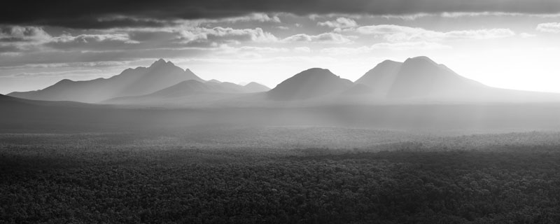
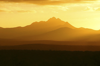
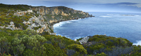
Heading further into the South West we were greeted by the dark peaks of the Stirling Ranges. Standing out starkly against the surrounding flat plains, they weren’t going to give away their secrets from such a distance.
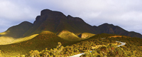
Arriving at the ranges, it’s only now we witness their true beauty. As well as the stunning peaks, their flora forms one of the world’s most important biological hotspots. Walking tracks in the area, especially around Bluff Knoll, really bring this home to us. The staggering array of flora, some that only grow in this park, really makes this region a special place.
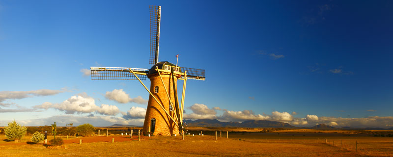
Whilst in the area we visited The Lily windmill, a sight which has recently become synonymous with the area. The windmill is a fully functioning replica of an authentic 16th Century Dutch windmill. Built by proprietor Pleun Hitzert, it really is a masterpiece.
 |
|
'The Lily' Windmill |
 |
|
Bluff Knoll |
 |
|
Stirling Ranges |
 |
|
Stirling Ranges |
West Cape Howe
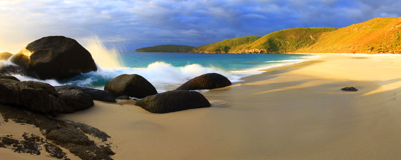
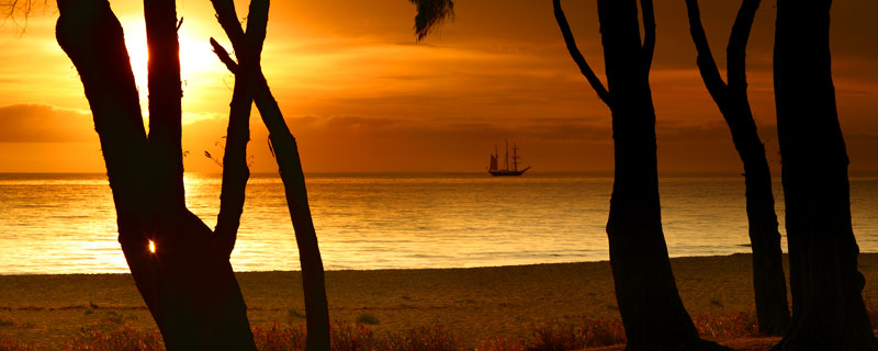
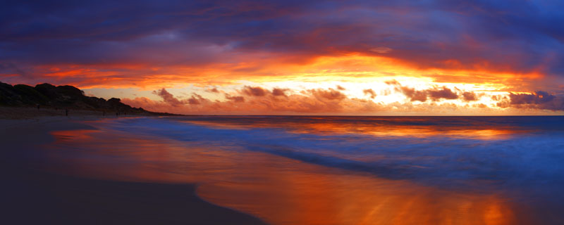
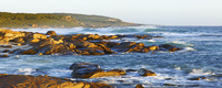
Heading south through Albany and on to West Cape Howe, we camped at the delightful Shelly beach. From late summer to early autumn, salmon make their migratory run to waters around Perth. At this time fishing is at a premium and licensed teams fish the park’s beaches, netting tonnes in a single catch.
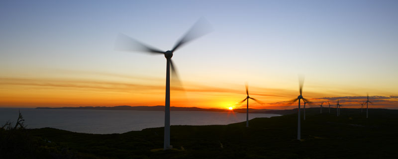
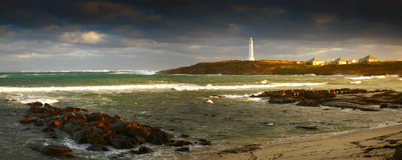
Overlooking the cape is the ever familiar sight of a coastal wind farm. Albany’s wind farm contains some 12 turbines which supply 75% of the towns’ electricity. Many feel that these wind turbines blight the landscape, but I feel that with the necessity to find alternative power sources, they can exist within the landscape and provide us with fascinating new viewpoints.
 |
|
Albany Wind Farm |
 |
|
Shelly Beach |
D’Entrecatreaux National Park
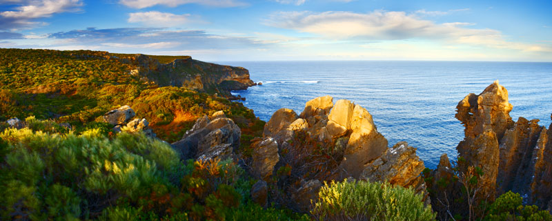
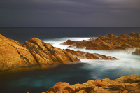
The rugged limestone cliffs of Cape D’Entrecatreaux perfectly frame the blues of the Southern Ocean. Sitting atop the deserted cliff gives you a real sense for the enormity of this land.
 |
|
D’Entrecatreaux National Park |
 |
|
Cape D’Entrecatreaux |
Margaret River
 |
|
Cape Leeuwin |
 |
|
Boranup Forest |
We’d been heading west along Australia’s southern coastline, flanked by the Southern Ocean, for almost three months now. Reaching Augusta, the southern gateway to the Margaret River was therefore a significant milestone for us. It’s here, at Cape Leeuwin, that the Southern and Indian Oceans meet. Australia’s tallest lighthouse serves to guard against its treacherous waters and makes for an impressive sight, especially with stormy skies looming over the cape.
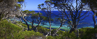
Along with the lighthouse, there are beautiful beaches, rivers, caves and forests that form the southern part of the Margaret River region. We based ourselves at the Conto campgrounds, just South of the town, allowing us easy access to the region.
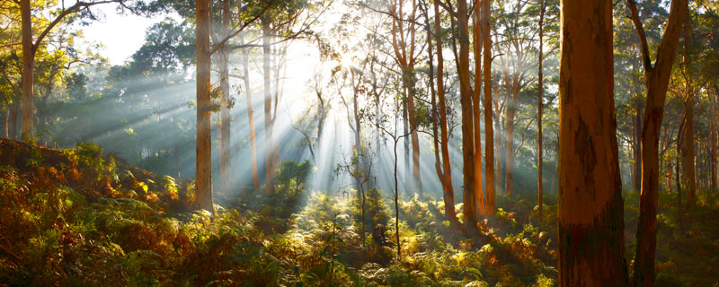
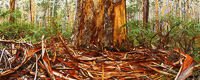
The unforgettable Boranup Forest covers some 3,200 hectares and is the largest known Karri forest growing in limestone sand. With some trees topping-out at over 60m, only the giant Californian Redwoods and Australia’s own Mountain Ash grow taller.
On my third visit to the forest I was greeted by the mornings’ first rays streaming through the trees. I felt very fortunate to be capturing the forest in such amazing light.
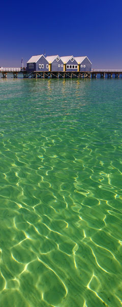
Moving north we explored the town of Busselton, with its 1841m long pier, the region’s many beaches, and its rugged coastline, including Sugarloaf Rock.
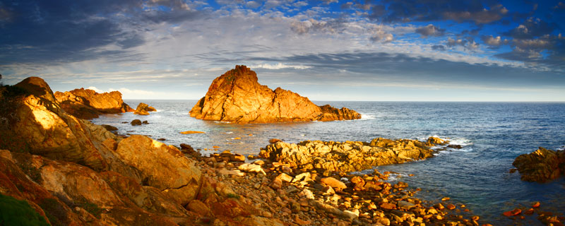
Sugarloaf Rock is an impressive granite formation, continually being pounded by the local swells. It’s these swells that draw surfers from across the country to the small town of Yallingup. Around this area residents are battling against further development, hoping to maintain the untouched beauty of the region. Simply taking a walk along Yallingup beach at sunset, without doubt, has us siding with the locals.
With such a rich variety of landscapes, the Margaret River has to be one of Australia’s premium locations for the photographer. Our stay only lasted a few days, not long enough to do the region justice. I suppose the only thing to remedy this would be a return visit. It’s a hard life!
 |
|
Sugarloaf Rock, Margaret River, WA |
 |
|
Busselton Pier |
|
 |
|
Meelup Beach |
 |
|
Yallingup Beach |
|
 |
|
Canal Rocks |
 |
|
Boranup Forest |
 |
|
Redgate Beach |
 |
|
Injidup Point |
|
Perth
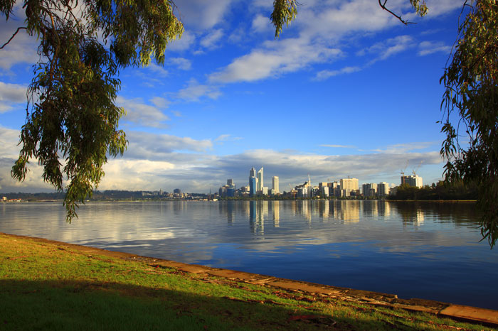
Reaching Western Australia’s capital meant almost 20,000 kilometres on the clock, and a third of the way through our trip.
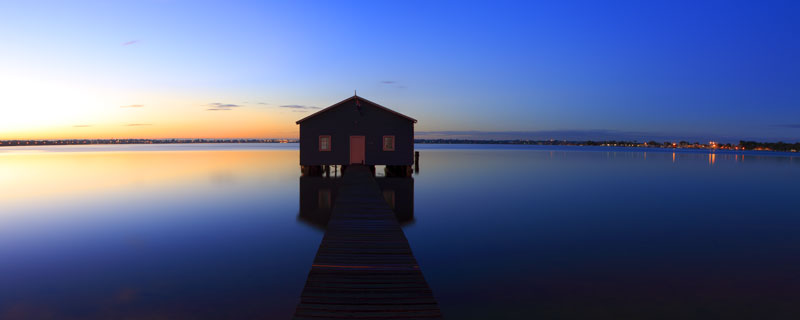
A visit to Sir James Mitchell Park, along the banks of the Swan River, provided an excellent location to photograph the city and its towering buildings. Also an early morning start enabled me to capture the still waters around Matilda Bay.
 |
|
Perth, WA |
 |
|
Matilda Bay, Perth, WA |
So time now to catch up with a few old friends and start to plan our trip North.
To read about the next leg of our journey, see new links on our Big Trip Homepage or receive notification via our newsletter subscription (bottom of our home page).